My travelogue from the Pamir Highway (M41) in Tajikistan and Kyrgyzstan, with photos and stories.
The original travelogue was published in Croatian and it had more than 200 photos and 110.000 characters (like a short novel).
Pamir Travelogue got lots of praise and was well received by the readers.
Photos are international by nature, so here is very short sample (less than 10%) of the full travelogue...
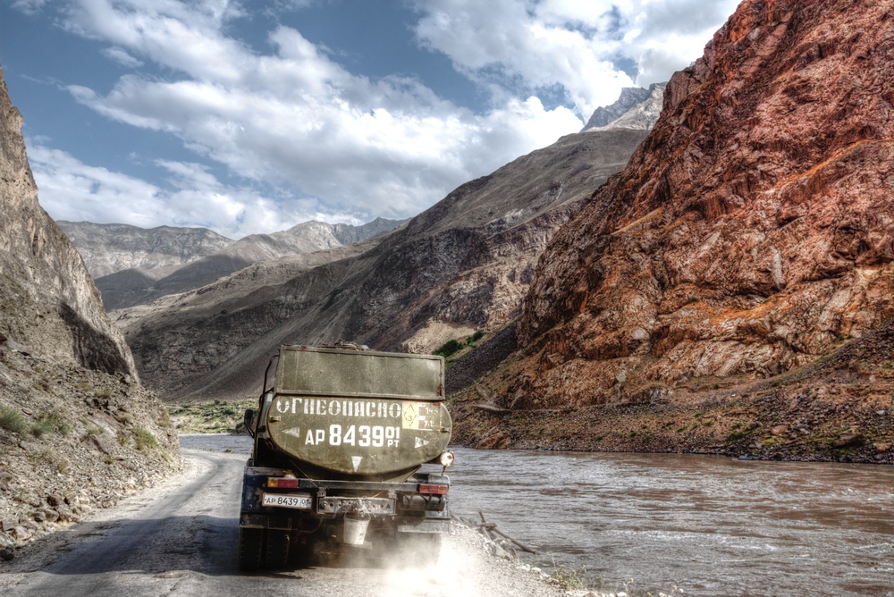
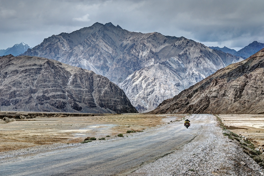
Tanker truck on the M41 road, between Vanj and Rushan in GBAO province of Tajikistan. M41 follows the river Panj for many miles. On the other side of the river is Afghanistan
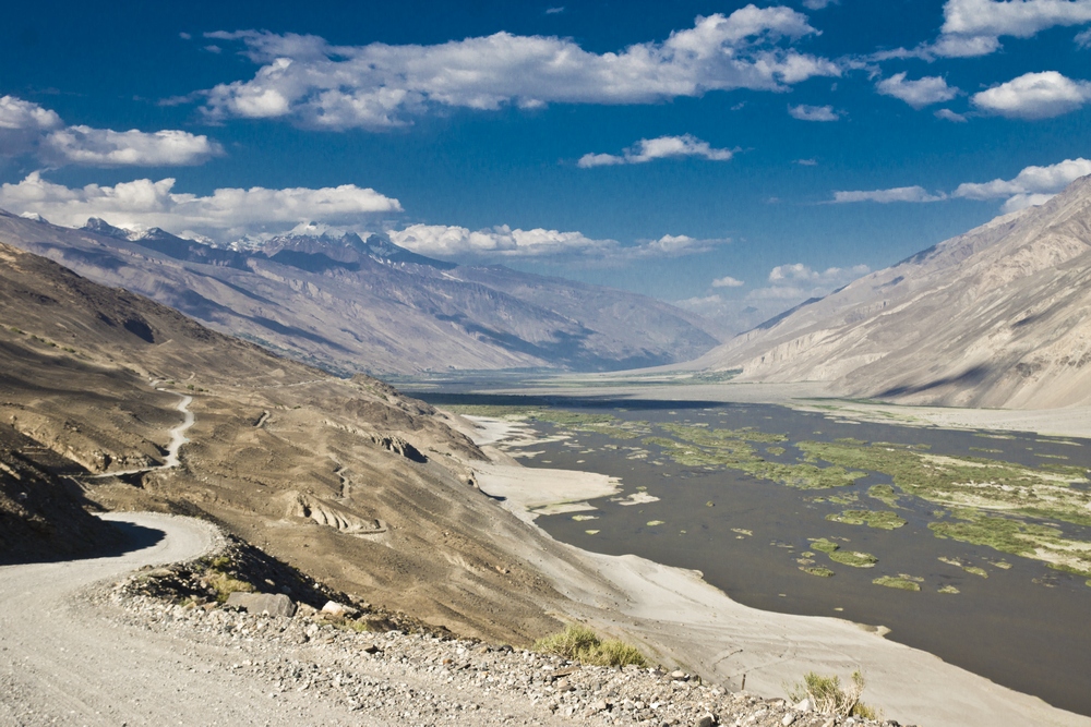
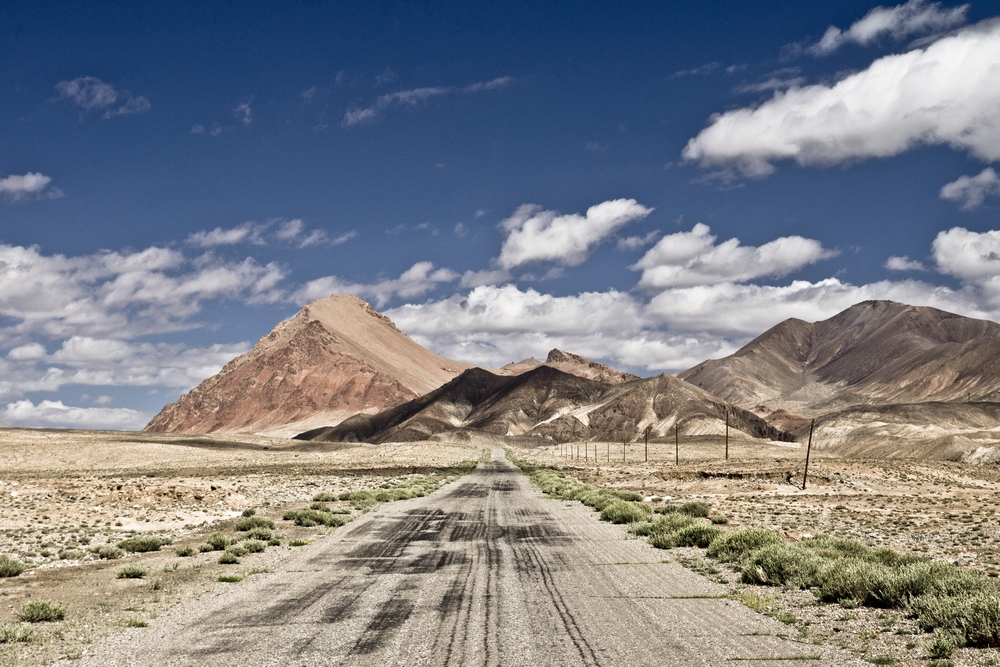
Panj river valley and M41 between Ishkashim and Langar. Again, Afghanistan is on the other side
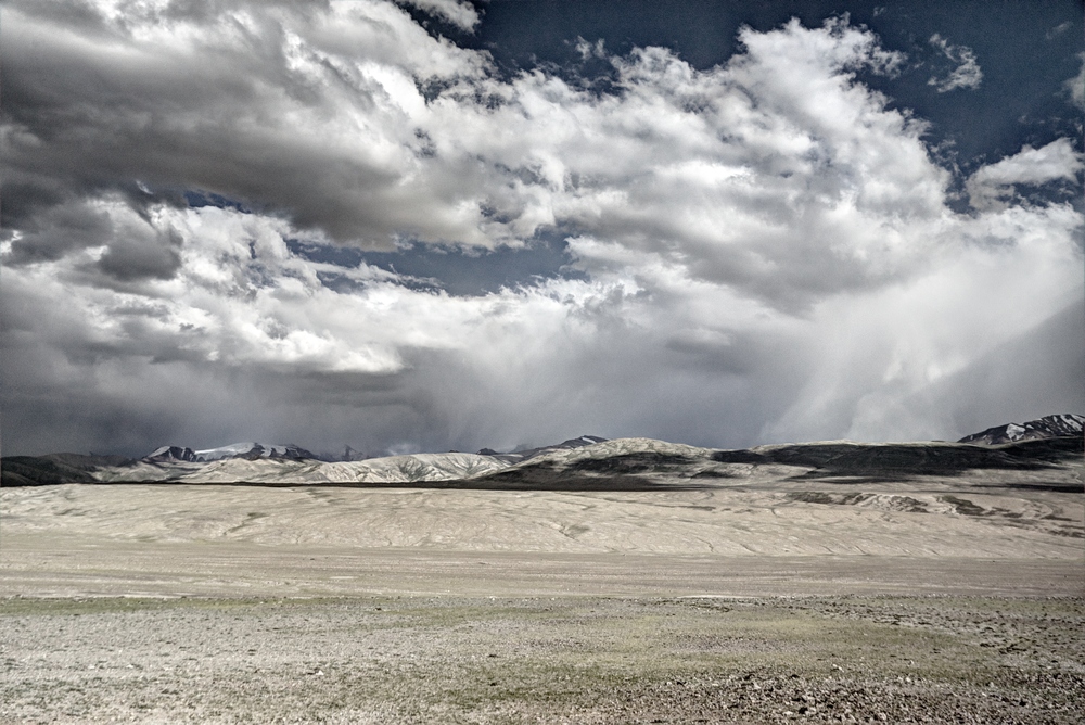
After Langar road is getting worse, narrow and dangerous mountain path in complete desolation, at altitude of around 3.600 meters, with no village for dozens of miles, and with similarly deserted, although geologically different, Afghanistan on the other side. After climbing for couple hours, we reach the highland before entering the mountains again, climbing towards Khargush pass (pereval)
After negotiating the Khargush pass, we will soon again meet M41, Pamirski trakt, coming from the west, and get to the Murghab plateau, magically remote and lonely, with very thin air
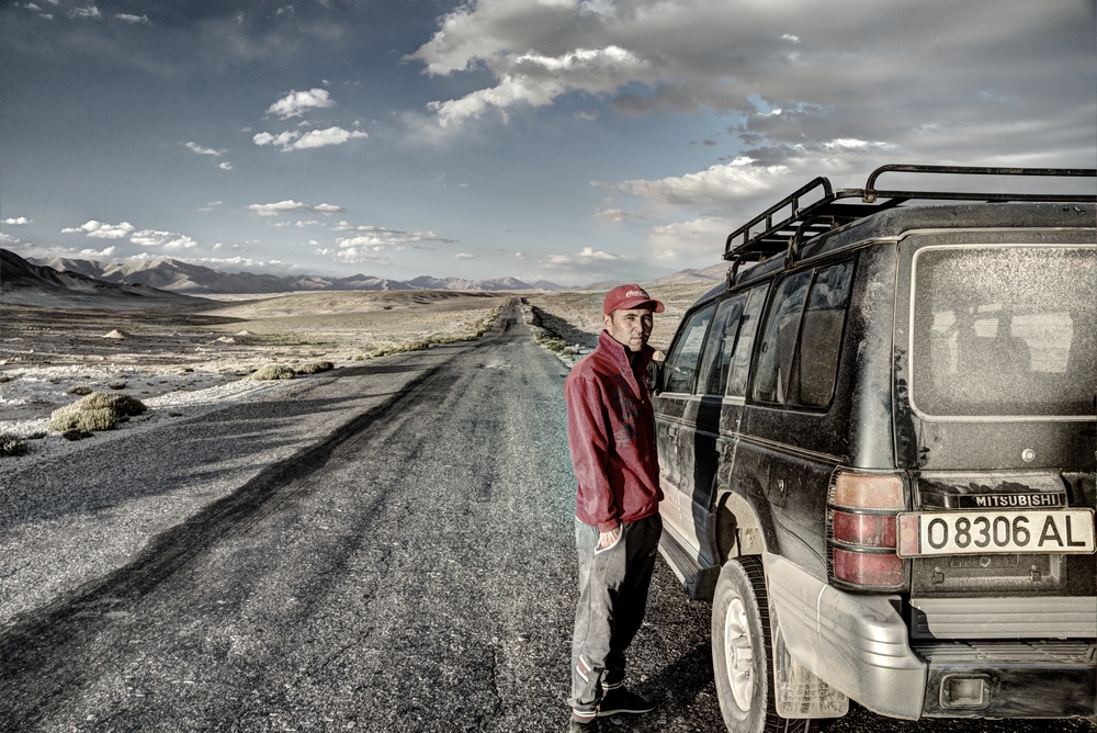
Back on M41, Pamirski trakt! It's late afternoon, sun is falling close to the wall of mountains that enclose the plateau from all sides, shadows get longer, and Nasir, our driver, needs rest.... altitude here is around 3.800-3.900 meters asl
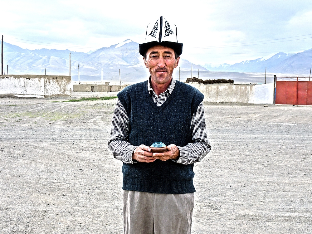
Tursunbay is so very pleasant and nice host, and the only one on our travel so far who speaks good English. He works as teacher in the local school in Alichur. He was so sorry because the plov (rice meal) his wife cooked gave me stomach trouble, and I wanted to show that I definitely don't hold it against him, so I gave him a gift – compass from Marco Polo Museum in city of Korcula, Croatia. He was very pleased. As usual, Marco Polo does not need any explanation or translation, here everybody knows about him, Silk Road went through these parts...
Tursunbay has traditional Kyrgyz hat on his head – this easternmost, furthest, most remote region of Tajikistan is populated by the Kyrgyz people
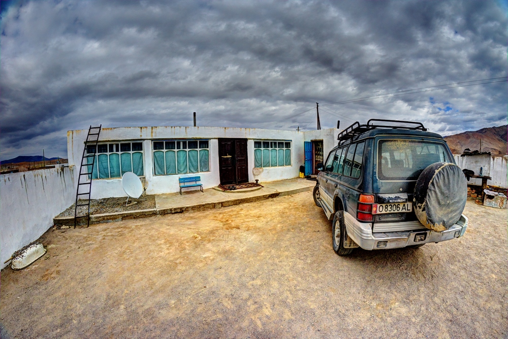
Tursunbay house, with the courtyard and our 4WD. All houses in Alichur village look similar, but this one is better kept
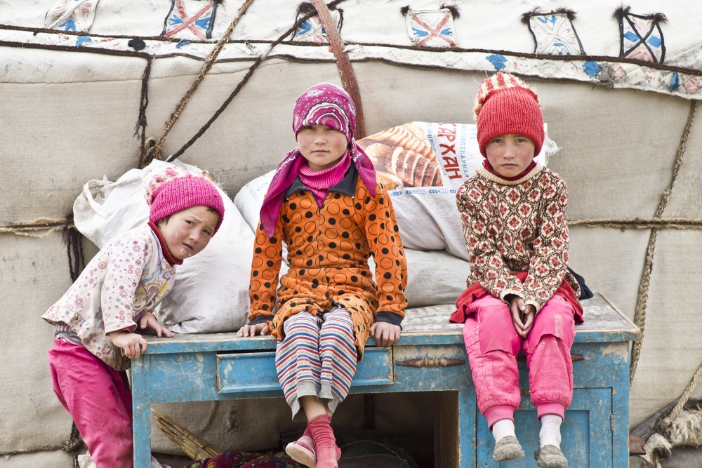
Kyrgyz kids from the nomad camp, on high plains near Alichur. In nomad camp there is plenty of work for the kids – herding the cattle, for example, and that's a big deal because cattle is the most valuable possession these people have. These kids are so young but their faces already show plenty of character that usually comes with age, look at those grown up facial expressions and serious, inquisitive eyes
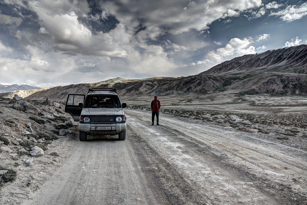
Alichur to Murghab, there were only a couple of vehicles on this section of the road, we passed lone Chinese flatbed truck and European motorcyclist, then we would stop to make photographs and they would pass us, then we would catch up on them and so on. On the whole section we didn’t see a single vehicle from the other direction. Murghab is one of the main bases on M41, so people who spend a night there usually start early in the morning, and we were already too late to meet them on the road before Alichur
So, this is the road from Murghab to Karakol, we leave the city that would be perfect as setting for some Sergio Leone movie, it's around 150 km to Karakol, not much, the road is terrible, and landscapes are among the most impressive on the road so far
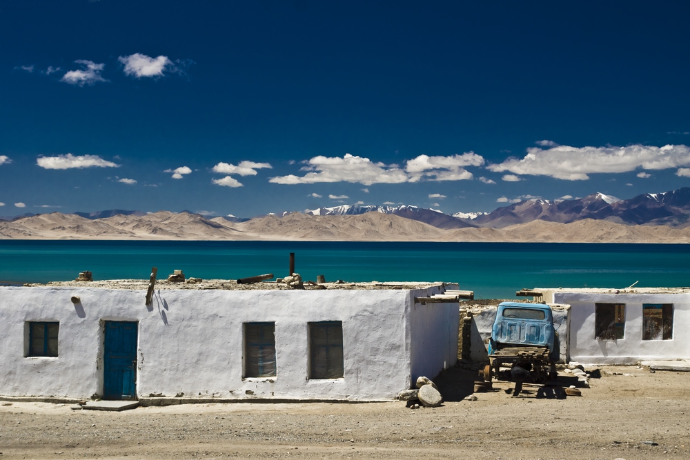
Karakol, on the shore of the homonymous lake. In Turkish languages it means simply the black lake. Lakes change colors throughout the year, and these days Karakol is beautifully turqoise. It's cold, wind blows fiercely, and the village, after Alichur and Murghab, pushes the envelope for isolation, loneliness and emptiness still further. Empty streets, if you call passages between the houses that, atmosphere and the surrounding landscape that is mix between Sahara, Mediterranean colors, and snow capped mountains, suggest something out of Twilight Zone or X-Files. There are no people to see. Sounds in the village echo among the houses in strange way. There is no electricity, and we don't even ask for Wifi lest we appear ridiculous...
Look at this photo…. It's like a parallel universe.... Dali, de Chirico, Magritte, masters of surrealism....
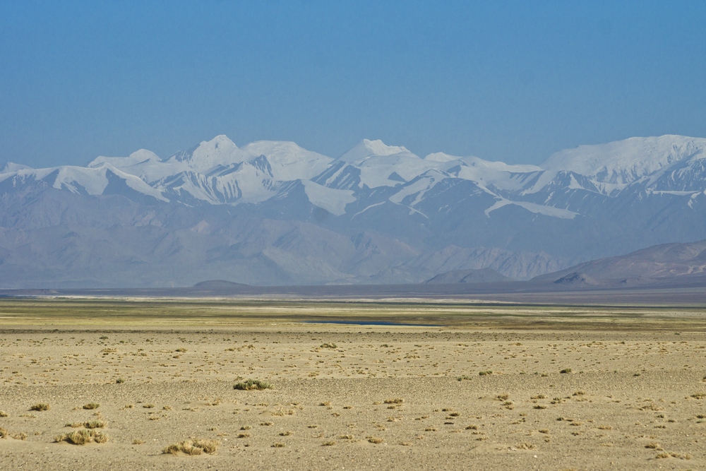
Road to Kyrgyzstan border goes through classic example of alpine desert, we climb up to Kyzyl Art pass at impressive 4.280m asl, which is still lower than both Aq Baital and Khargush passes, and finally to the border…
One of the peaks on the photo is the famous Pik Lenin, 7.134m, on the border of Tajikistan and Kyrgyzstan. It is allegedly one of the easiest 7-thousand peaks to climb and very popular. In Soviet Union the hierarchy of peaks was a big deal. The highest peak was Pik Komunizma - because communism was the highest value - which is also in Tajikistan. Pik Komunizma was called Pik Stalina for some time - because Stalin, while he was alive, was above Lenin, you see… Two 6-thousanders in south Pamirs were Pik Marksa and Pik Engelsa - obviously totally unrelated to the native local names or the names of the Russian person(s) who first discovered them.
Soviet Union had special award for climbers of all Soviet 7-thousanders: Снежный барс, the Snow Leopard. Snow Leopards still live in small numbers in the mountains of Central Asia, and is an endangered species, with couple thousand animals surviving.
To get a Snow Leopard, a climber should get atop peaks: Komunizma, Pobede (Victory), Lenina, Korzhenevskaye, and Khan Tengri. Komunizm and Pobeda now have local Tajik and Kyrgyz names. Korzhenevskaya, surprisingly, does not have, and never had ideologically motivated name, it was named after a wife of Russian Imperial geographer who located the peak in 1910. Khan Tengri, which is on the border of Kazakhstan and China, as far as I know had the local name - meaning The King of Skies - since it was discovered. Khan Tengri is also smallest 7-thousander on the list.
And what about Lenin?
At first, the peak was named after Konstantin Kaufman, Austrian-born general in the Russian Imperial service who was remembered as "gubernator" of Russian Central Asia during the period of the largest colonial expansion. After the October Revolution peak was named after Lenin, and since the breakup of the Soviet Union it has two names - for Kyryz it is still called Pik Lenin, because most climb routes are from their side, and Lenin has huge marketing potential, they have merchandise with Pik Lenin and Lenin's face, hats, t-shrts etc. For Tajiks, the peak is called Qullai Abuali ibni Sino - so, the peak of Avicenna, famous medieval scientist and mathematician, who was simply "taken" by Tajiks as one of them. Check out the evolution in naming the peak - Kaufman, Lenin, Avicenna! Assuming you already know something about Lenin and Avicenna, if you're going to google someone - google Kaufman...
======
This is just a small sample of photographs from the project (12 out of more then 200), with very short, basic captions, except for the last photo. Full text had 110.000+ characters.
If you like what you see, consider supporting my next adventure journalism project, Lost Kingdom. Drop me an e-mail at olegm@iskon.hr to get timely info when the project starts.
All photos: Copyright Oleg Mastruko. Don't use without written permission.
Photo Projects: Without People / Expiations / Sea Dust Air (work in progress)
Travel projects: Pamir / Lost Kingdom /// Bio + Contact